Welcome to the map5topo website!
map5topo is a topographic digital map covering The Netherlands plus parts of bordering countries. The map5topo project started in April 2022 and is ongoing since.
Source data originates from Open Datasets like the Dutch "Key Registries" ("Basisregistraties": BAG, BRT, BGT, BRK, AHN, ...) and from OpenStreetMap.
map5topo is provided by map5.nl via OGC tiled web services like WMTS, but also "XYZ" (Google/OSM tiles, a.k.a. Web Mercator) tiles. Currently only raster (image) tiles, including "HQ Retina". Vector tiles are under development.
This website now covers mainly work-in-progress documentation. Eventually map5topo will be an Open Source project. At the moment we are cleaning up code and more, as to have a more accessible project. Be patient!
Please see the left-hand navigation for the table of contents.
Demo
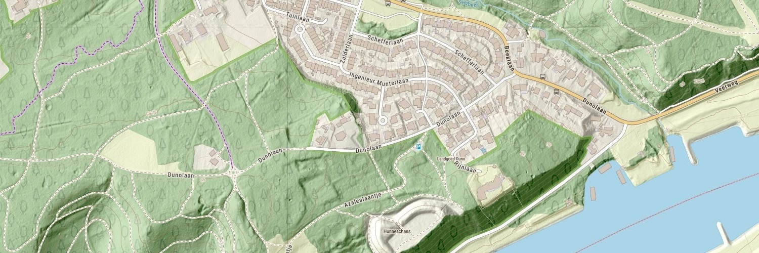
View map5topo in full interactively.
Mobile App
There is a free map5topo app for mobile phone (Android, iPhone).
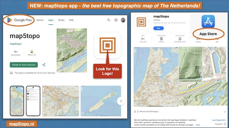
Download and install from the App Store for iPhone or for Android from the PlayStore.
Gallery
Watch work in progress screenshots in the Gallery.
Newsletter
Stay uptodate through the Newsletter. For map5topo developments, start with Newsletter nr 5. (In Dutch, sorry).
Presentations
map5topo and its development has been presented on multiple events, latest first:
- "Wie MapLibre und Vektorkarten die Welt übernehmen" - In German - FOSSGIS 2025, Múnster, Germany - March 26, 2025 - abstract - VIDEO - [PDF Slides].
- "Basisregistraties en OpenStreetMap mixen voor map5topo kaarten" - FOSS4G-BE-NL - Baarle - Sept 26, 2024 - [PDF Slides].
- "Melting Dutch open data and OpenStreetMap into a single schema" - Maptime AMS - September 19, 2024 - [PDF Slides]
- "map5topo - een nieuwe, frisse topokaart van Nederland" - OSGeo.nl FOSS4GNL Middelburg - September 14, 2023 - [PDF Slides]
- "Introducing map5topo - a new Topographic Map of The Netherlands" - Information Sessions - Oktober 5+6, 2022 - Online - Dutch - [PDF Slides]
- "map5topo - a New Topographic Map of The Netherlands" - Geomob Barcelona - November 22, 2022 - [PDF Slides] .
Video
Even more curious? Watch a video presentation of work-in-progress:
Support
For help and/or questions, send email to our Helpdesk. If you find errors or have suggestions, you can also report directly on GitHub.
